
Considered one of the great historical sites of the United Kingdom, Kenilworth has evolved throughout its history, even the landscape around changing, and being changed, by this castle. This map shows the historical layout of Kenilworth, with “The Mere” coming right up to its walls forming a formidable defensive barrier, blended with the contemporary ruins of the castle, including sally-ports and secret tunnels.
Visiting this castle to research and map was superb. The staff and volunteers were so helpful and engaging, telling me tales and secrets of the castle and helping me find and trace the routes of the secret tunnels. And apparently my great-grandfather was the Whipping-in Boy at the castle. I’m still not sure what that means.
Each map is created through a combination of detailed historical research, field-work and modern cartographical techniques, blended with my passion for history, places and maps.
All of the cartography is my own, drawn in my distinctive style, and no AI is used in my work
This A3 map is printed onto Museum-Quality Archival paper, ensuring a high-quality and long-lasting piece of art for your wall. It comes unframed or in a wooden frame, with a range of frame colours to chose from.
Unframed £48
Framed £68
Free Worldwide Shipping
Notes Each piece is individually printed, and subtle variations in tone and finish may occur.

Considered one of the great historical sites of the United Kingdom, Kenilworth has evolved throughout its history, even the landscape around changing, and being changed, by this castle.
This map shows the historical layout of Kenilworth, with “The Mere” coming right up to its walls forming a formidable defensive barrier, blended with the contemporary ruins of the castle, including sally-ports and secret tunnels.
Visiting this castle to research and map was superb. The staff and volunteers were so helpful and engaging, telling me tales and secrets of the castle and helping me find and trace the routes of the secret tunnels. And apparently my great-grandfather was the Whipping-in Boy at the castle. I’m still not sure what that means.
Each map is created through a combination of detailed historical research, field-work and modern cartographical techniques, blended with my passion for history, places and maps.
Print Options; Memento (A5)
Free Worldwide Shipping
Notes Each piece is individually printed, and subtle variations in tone and finish may occur.
Considered one of the great historical sites of the United Kingdom, Kenilworth has evolved throughout its history, even the landscape around changing, and being changed, by this castle.
For much of its history it was a royal castle, and inside its walls today are examples of mediaeval, early Renaissance and Elizabethan architecture.
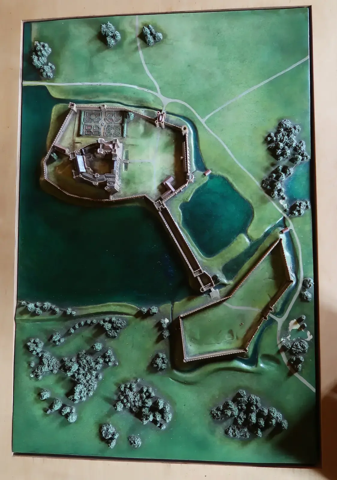
The earliest iteration of a castle here was in the 1120’s, when the Norman great tower was built. In the 13th century, King John had an outer circuit of stone walls added and a dam was built creating a large lake, known as the Mere, forming a vast moat and making this one of the most formidable fortresses in the kingdom at the time.
Later, in more peaceful times, the castle became a palace, with the great hall and the surrounding apartments being added, with large kitchens to make this a place for feasting and celebrations.
By the 15th century, Kenilworth had become the favoured residence of the Lancastrian Kings and Henry V built a retreat at the far end of the lake, known as “The Pleasance in the Marsh”.
In the latter part of the 16th century, Kenilworth was converted again, this time by Robert Dudley, in order that he might lavishly entertain Elizabeth I (in 1575 nineteen days of entertainment were held here).
Like many castles, Kenilworth was dismantled following the Civil War, later becoming the setting for Walter Scott’s 1821 novel “Kenilworth”, a romanticised telling of the story of Robert Dudley and Elizabeth I.
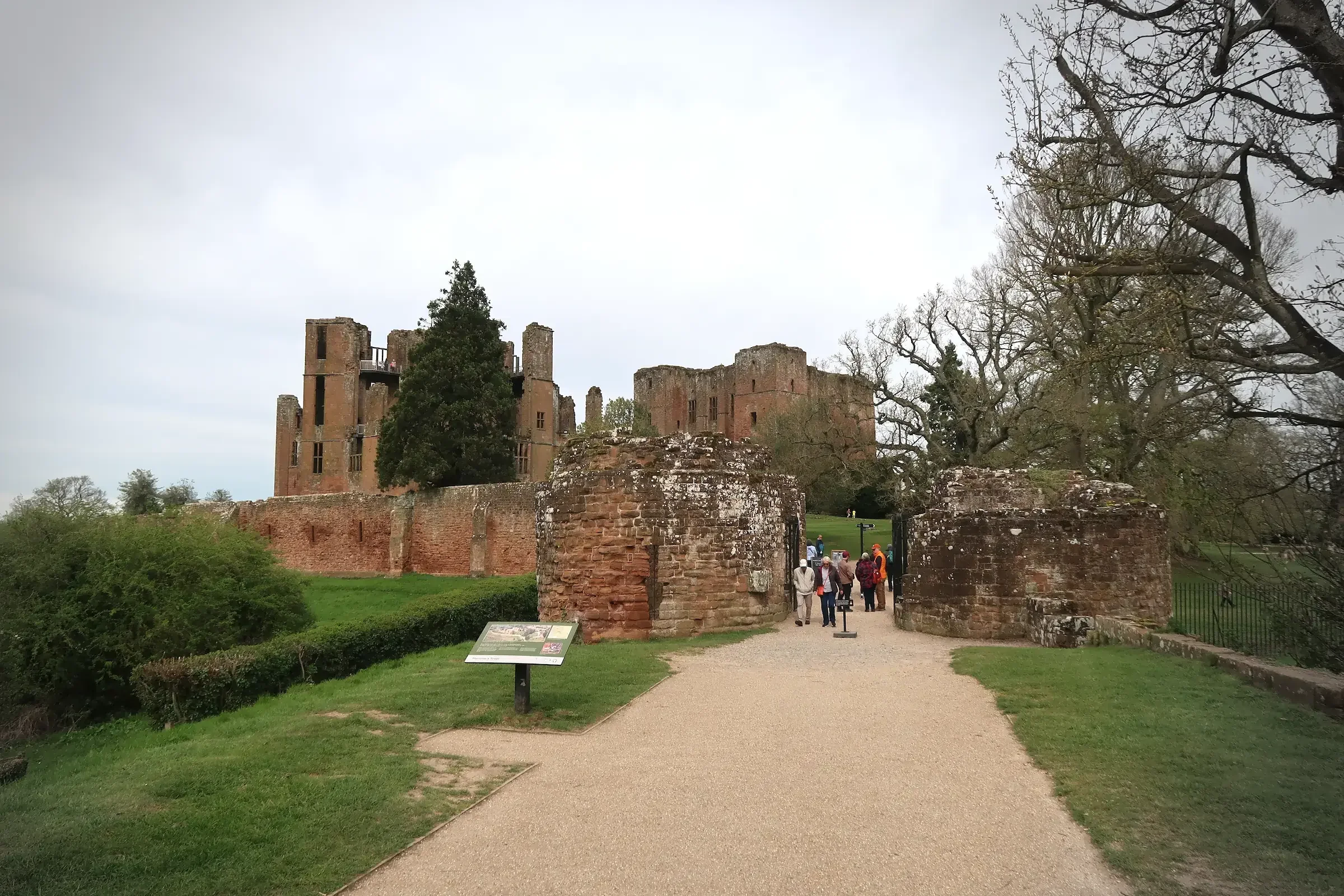
As you approach the castle, along what feels like a causeway, the land around is flat and bare. This was once the site of the Mere, the great lake which was formed to defend the castle; the locals say it still floods most winters. This was one of the first decision points for this map - whether to show this area as it is today or as it would have been. On display is a model of the castle from the 13th century, showing where the Mere would have been around the walls. I love the shapes that this forms and wanted the map to harken back to those days when this was a formidable fortress, whilst at the same time showing its current ruined condition.
Once inside the walls, the imposing buildings of the Great Hall and the Great Tower dominate, majestic in their ruination. These give a strong impression of the power and wealth that was here, and climbing to the top of the towers gives an idea of the views which were in mind for these royal apartments (and some thought as to what it would have taken to bring service up and down all those steps).
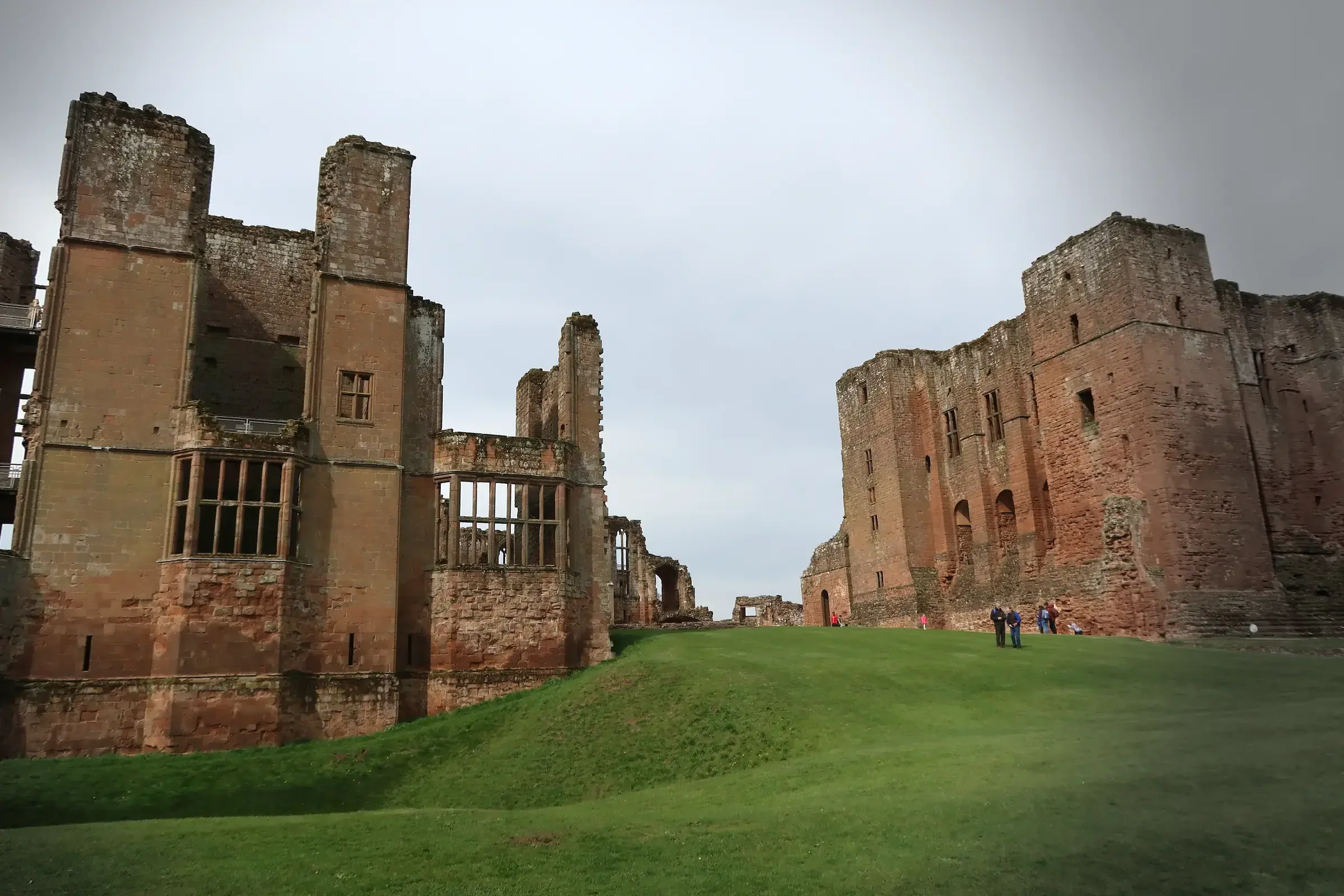
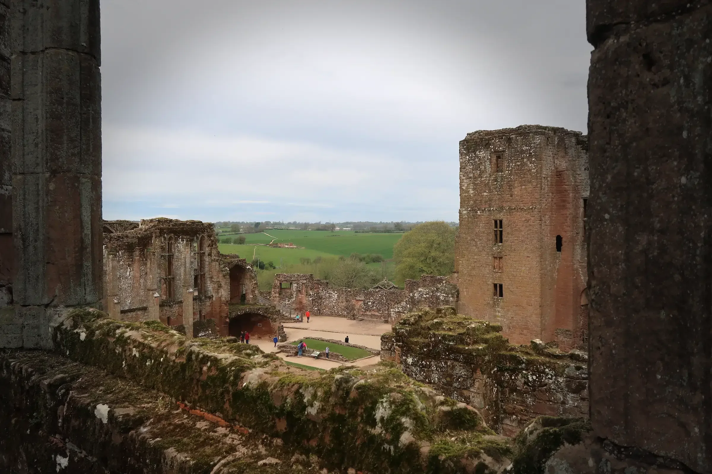
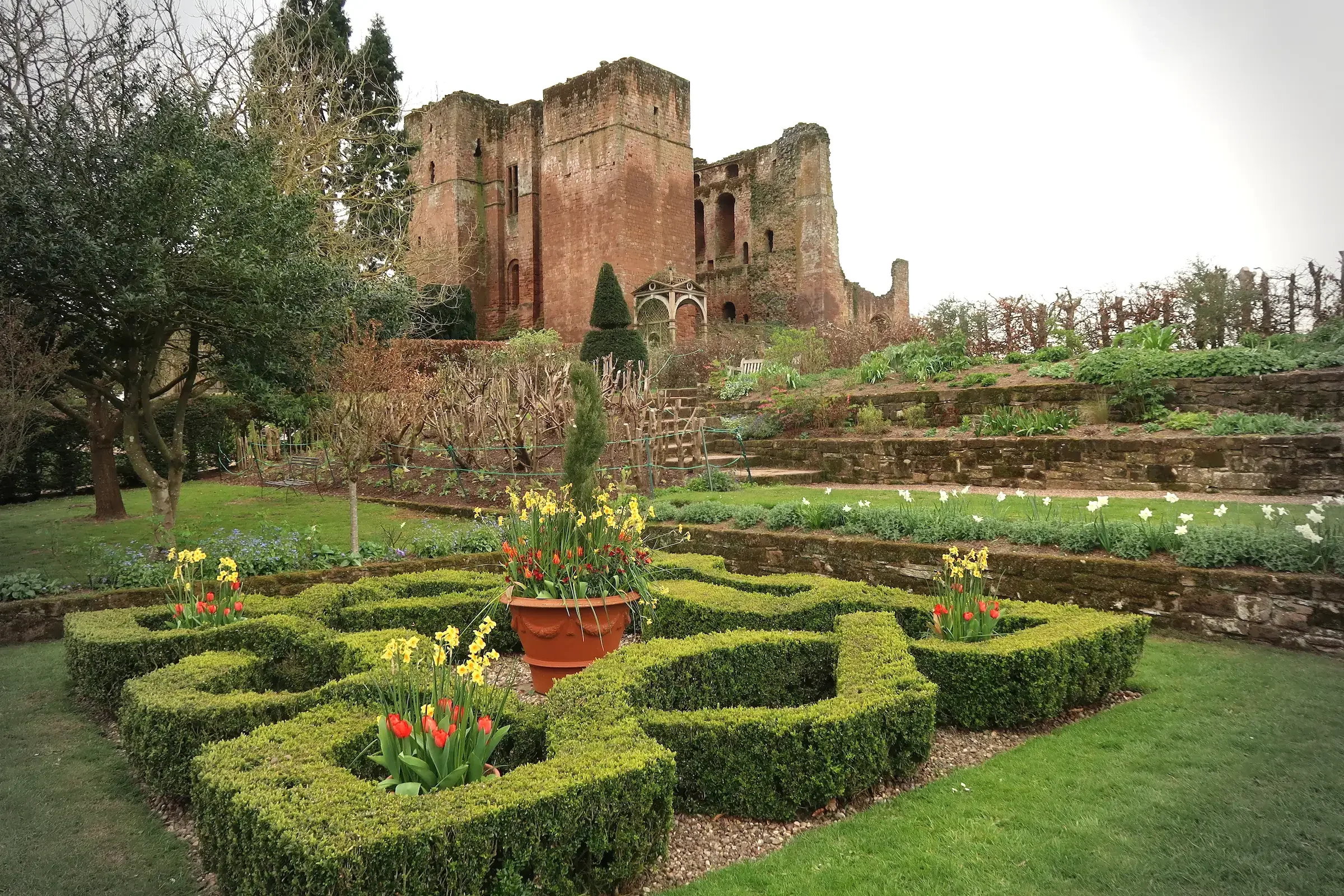
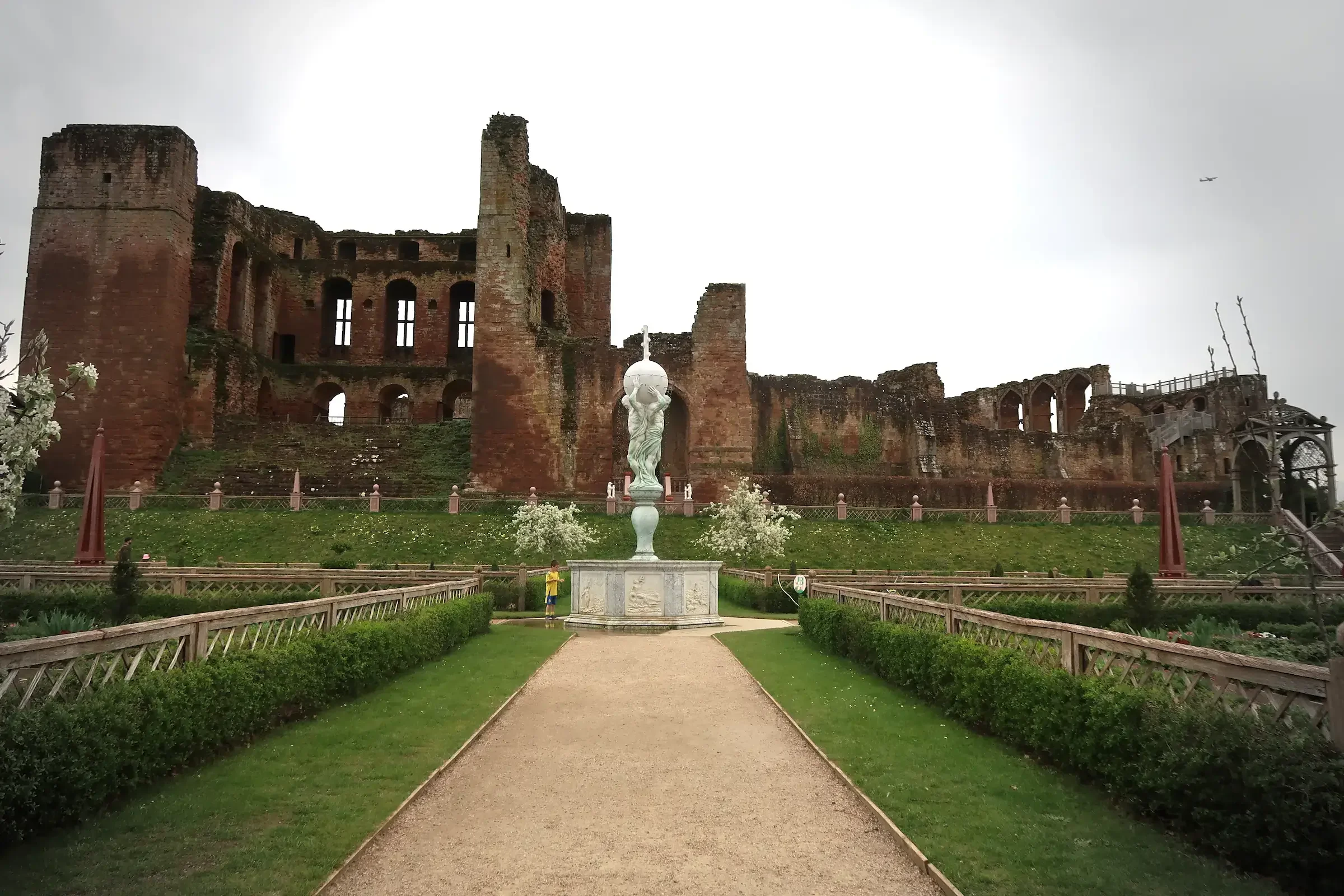
These stone walls stand in stark contrast to the pleasant gardens next to them, giving the feeling of walking through Kenilworth’s iterations through time.
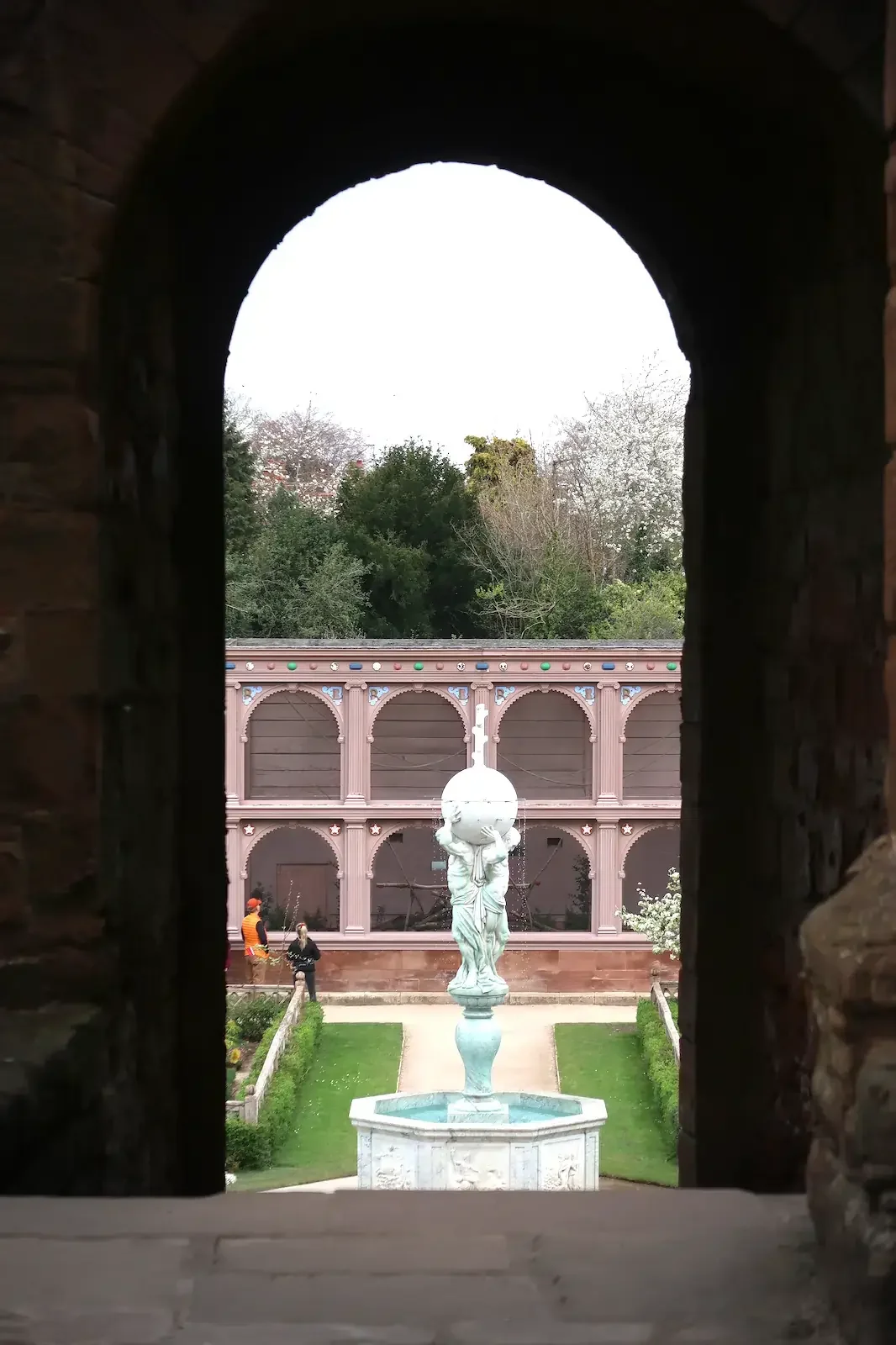
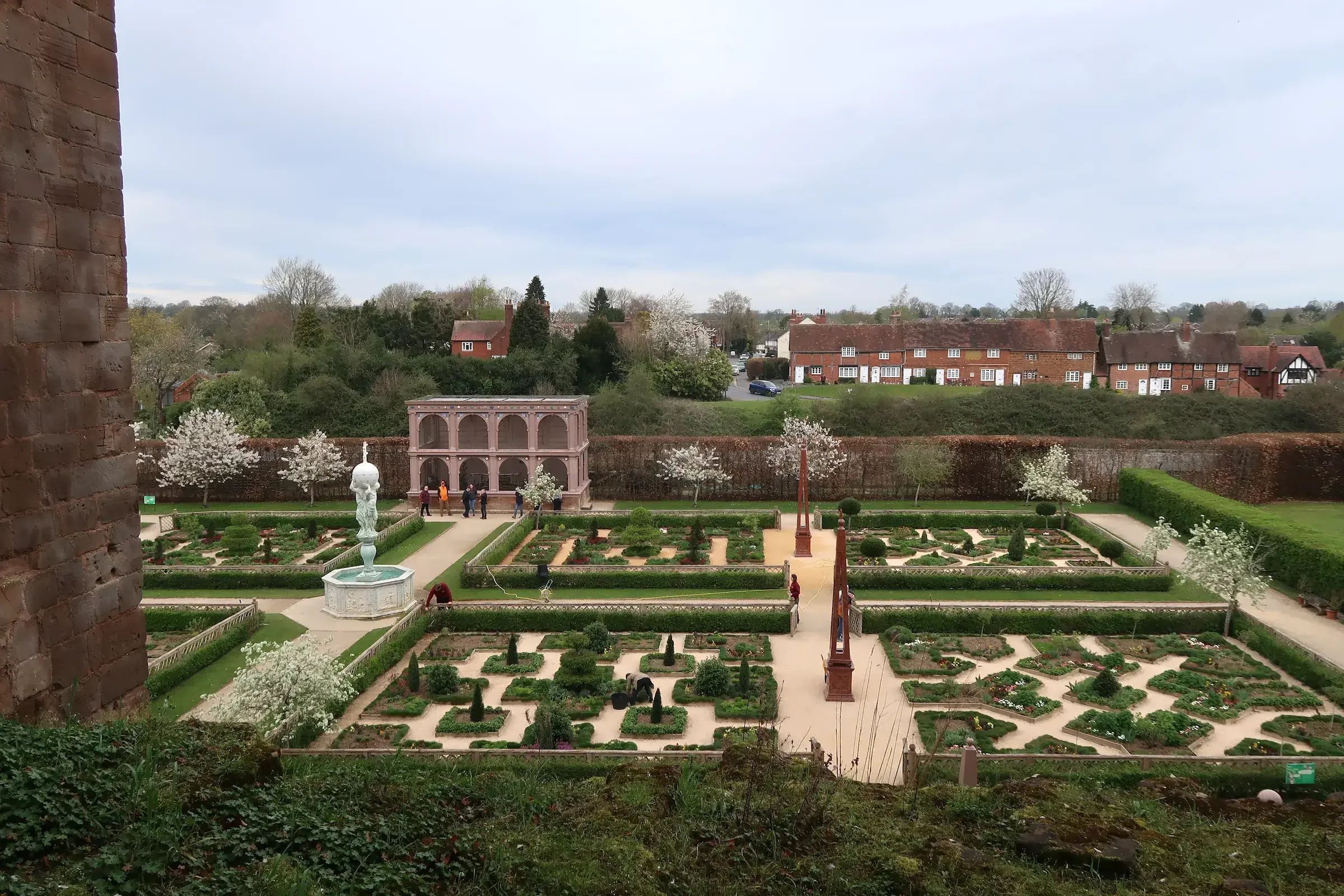
The Elizabethan garden was created by Robert Dudley, so that Elizabeth I might have somewhere pleasant to stroll during her stays. The gardens here today are a reconstruction, based on an account by Robert Langham in 1575, an official of Robert Dudley’s household who gained access to the gardens whilst the queen was out hunting and, in a letter, described the gardens in great detail.
I got chatting to some of the volunteers at the castle, who, now retired, grew up in the village. They recalled that there was a secret tunnel through which the village children used to access the castle for free, but that it had long-since been bricked up and they couldn’t quite recall where it was. Though they were able to show me the sally port next to Lunn’s Tower.
I simply had to investigate these tunnels and was introduced to Sarah, one of Kenilworth’s keen historians, who knew exactly where one tunnel was and where the other began - though not where it ran or came out.
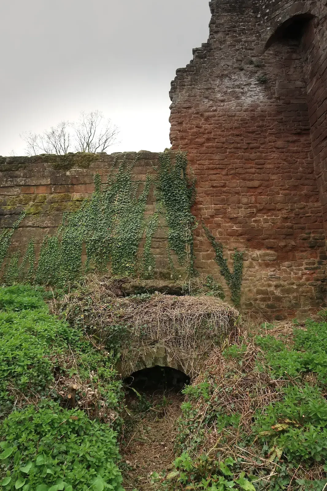
I was first shown the tunnel which ran from near Mortimer’s Tower and out at the Water Tower. The second tunnel began next to the kitchens. Determined that we should discover more about this, we consulted the old plans which showed the Mere, to determine where it may feasibly have emerged beyond the castle walls, and then set off on a circuit to see if we could find it. Much of the outside of the walls were covered in brambles and nettles at their base, making it hard to see where a small, discreet tunnel may have emerged. After some searching, though, we spotted a small entrance near the Kings Gate, just big enough for someone to crawl through. The tunnel was clearly old and had been blocked up with modern bricks. Now that we had both ends of the tunnel, we were able to plot its route for the map.
Considered one of the great historical sites of the United Kingdom, Kenilworth has evolved throughout its history, even the landscape around changing, and being changed, by this castle. This map shows the historical layout of Kenilworth, with “The Mere” coming right up to its walls forming a formidable defensive barrier, blended with the contemporary ruins of the castle, including sally-ports and secret tunnels.
Visiting this castle to research and map was superb. The staff and volunteers were so helpful and engaging, telling me tales and secrets of the castle and helping me find and trace the routes of the secret tunnels. And apparently my great-grandfather was the Whipping-in Boy at the castle. I’m still not sure what that means.
Each map is created through a combination of detailed historical research, field-work and modern cartographical techniques, blended with my passion for history, places and maps.
All of the cartography is my own, drawn in my distinctive style, and no AI is used in my work
This A3 map is printed onto Museum-Quality Archival paper, ensuring a high-quality and long-lasting piece of art for your wall. It comes unframed or in a wooden frame, with a range of frame colours to chose from.
Unframed £48
Framed £68
Free Worldwide Shipping
Notes Each piece is individually printed, and subtle variations in tone and finish may occur.
Considered one of the great historical sites of the United Kingdom, Kenilworth has evolved throughout its history, even the landscape around changing, and being changed, by this castle.
This map shows the historical layout of Kenilworth, with “The Mere” coming right up to its walls forming a formidable defensive barrier, blended with the contemporary ruins of the castle, including sally-ports and secret tunnels.
Visiting this castle to research and map was superb. The staff and volunteers were so helpful and engaging, telling me tales and secrets of the castle and helping me find and trace the routes of the secret tunnels. And apparently my great-grandfather was the Whipping-in Boy at the castle. I’m still not sure what that means.
Each map is created through a combination of detailed historical research, field-work and modern cartographical techniques, blended with my passion for history, places and maps.
Print Options; Memento (A5)
Free Worldwide Shipping
Notes Each piece is individually printed, and subtle variations in tone and finish may occur.
