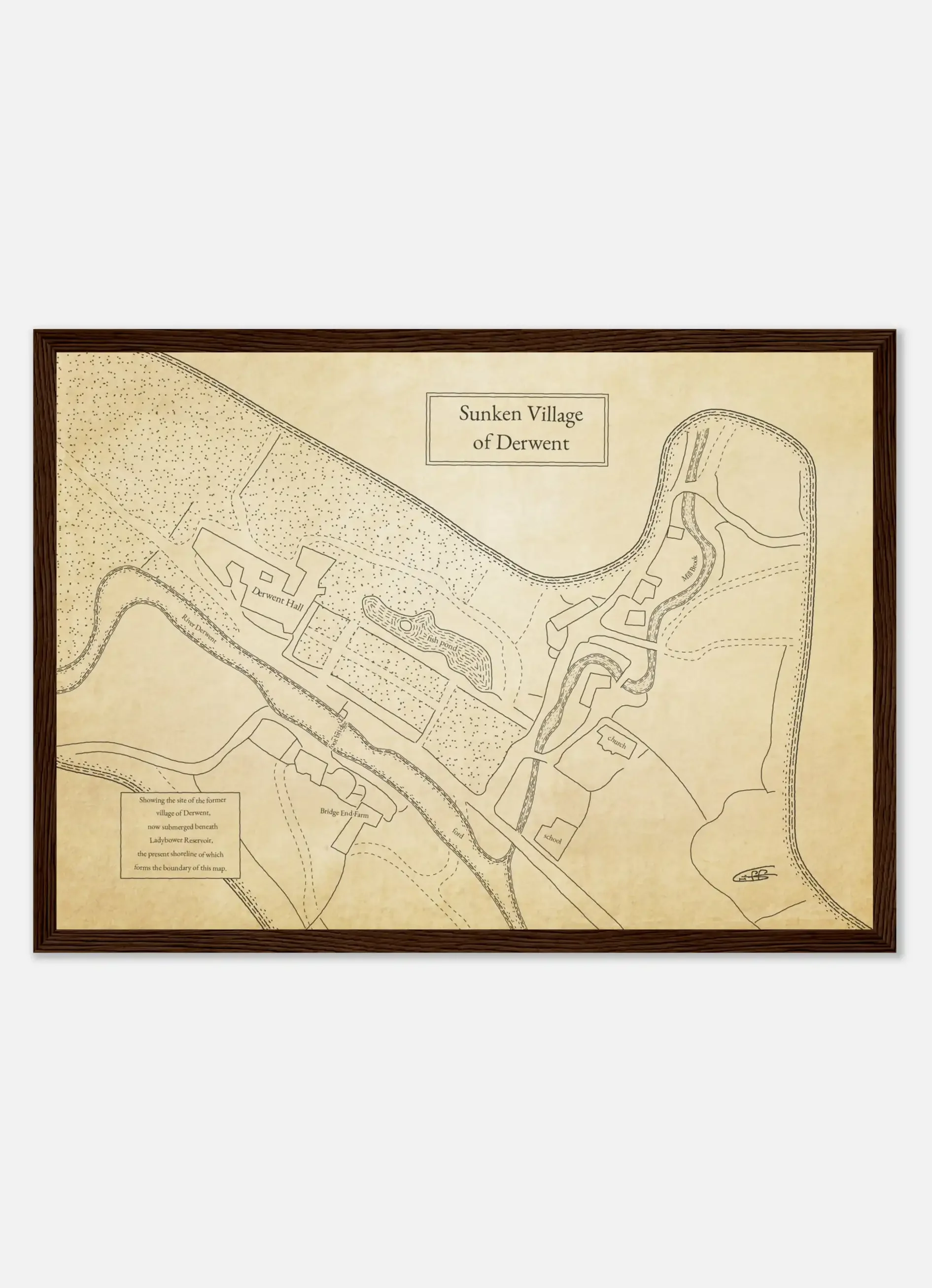
This map shows the area of the village of Derwent which now lies underwater, bounded by the modern-day shore of Ladybower reservoir. Researched from national archives and geospatially correlated to the reservoir, this map prides an insight into this now lost village in the heart of the Peak District.
The area around these reservoirs is amongst my favourite stomping-grounds, and whilst walking I often wondered about the old village beneath the waters. It was a real pleasure, and fascinating, reading into the history of the area and poring over the old maps to build a picture of what lies beneath.
All of the cartography is my own and no AI us used in my work.
Print Options; archival (A3)
Unframed £48
Framed £68
free world-wide shipping
Notes: Each piece is individually printed, and subtle variations in tone and finish may occur, reflecting the nature of fine art production.

This map shows the area of the village of Derwent which now lies underwater, bounded by the modern-day shore of Ladybower reservoir. Researched from national archives and geospatially correlated to the reservoir, this map prides an insight into this now lost village in the heart of the Peak District.
Print Options; memento (a5)
Notes: Each piece is individually printed, and subtle variations in tone and finish may occur, reflecting the nature of fine art production.
The waters rose, the stones sank and the voices and community fell silent. Derwent Village had been drowned by the reservoir.
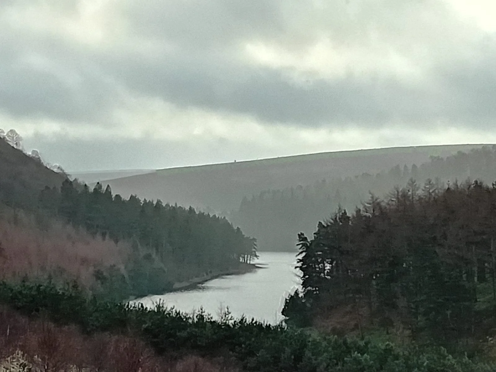
The morning was cool as I set off from the car park by the Ladybower reservoir, beneath which Derwent village lies. It was a quiet morning, mid-week and off season, and the valley was peaceful. A steady, persistent rain fell.
I knew there wouldn't be anything to see of the village, but I nevertheless wanted to get a feel for the place. I had researched old map archives to understand how Derwent Village had lain, how it had changed over time.
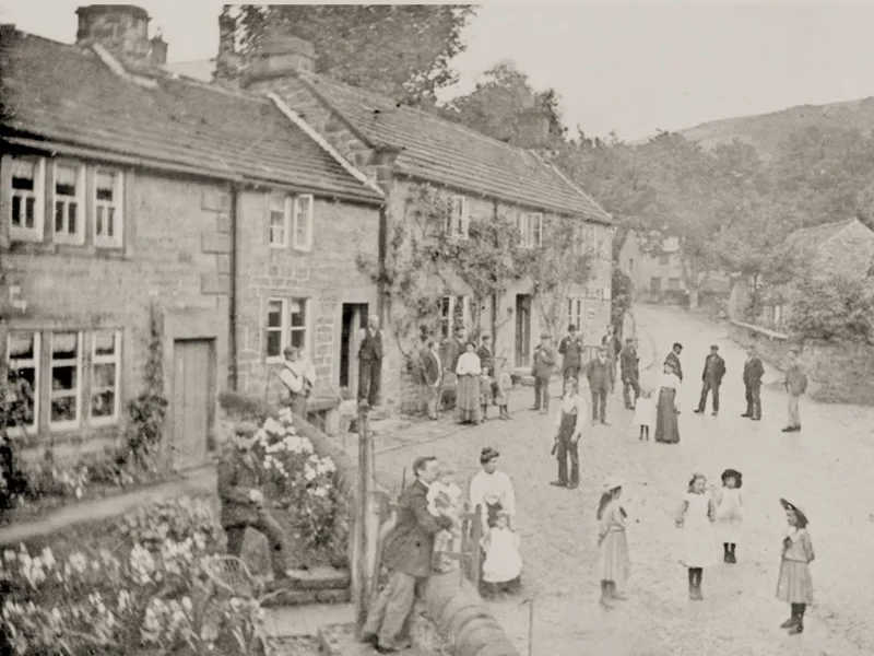
A settlement had developed at the site of Derwent village, in the Peak District, by the mediaeval period, and the village could trace its name and records back to the 13th century.
This was what might be described as a typical, functioning rural village. Most of the work was agricultural, alongside a mixture of estate-work, crafts and local trades. The village had a water-powered flour mill, there were winding streets and stone cottages, bridges, ale-houses, a school and places of worship.
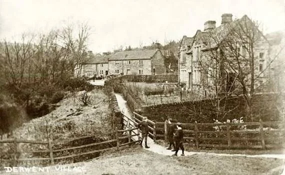
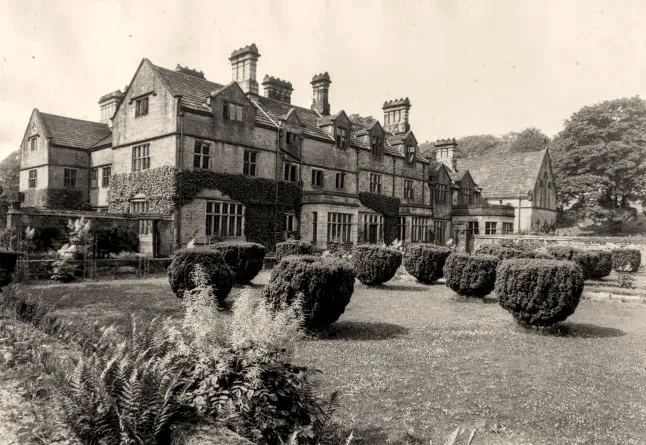
The village church was built in 1757, seating 140 parishioners, and Derwent Hall, a graceful country manor house, was built in 1672. Once owned by the Duke of Norfolk, it had gardens, ornamental trees, a fish pond and an estate of over 1,200 acres.
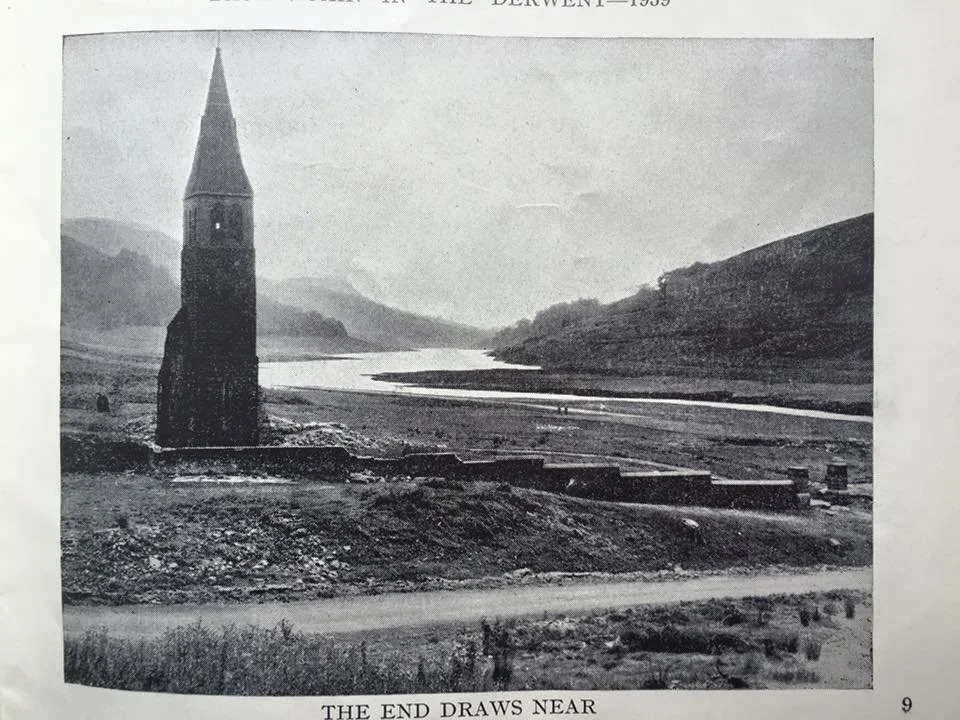
When the reservoir is low, people claim they yet see the shapes of old buildings rippling beneath the surface and local legend holds that when the conditions are right, the winter at its darkest and the mists lying heavy, the old church bell can be heard tolling mournfully beneath the dark waters.
The bell was in fact removed from the church before the valley was flooded, being re-homed in St Philip's Church in Chaddesden, yet this tale endures. Walking alone along the banks in this weather it's easy to feel why.
I now turned north, to walk the route around Derwent and Howden reservoirs, as more of this story was to be found along those paths.
Soon, the dam wall rose, vast and high above me, water cascading, roaring down its front.
A steep climb brought me level with the reservoir and I set off along its eastern shore. It was quiet, the water still and flat.
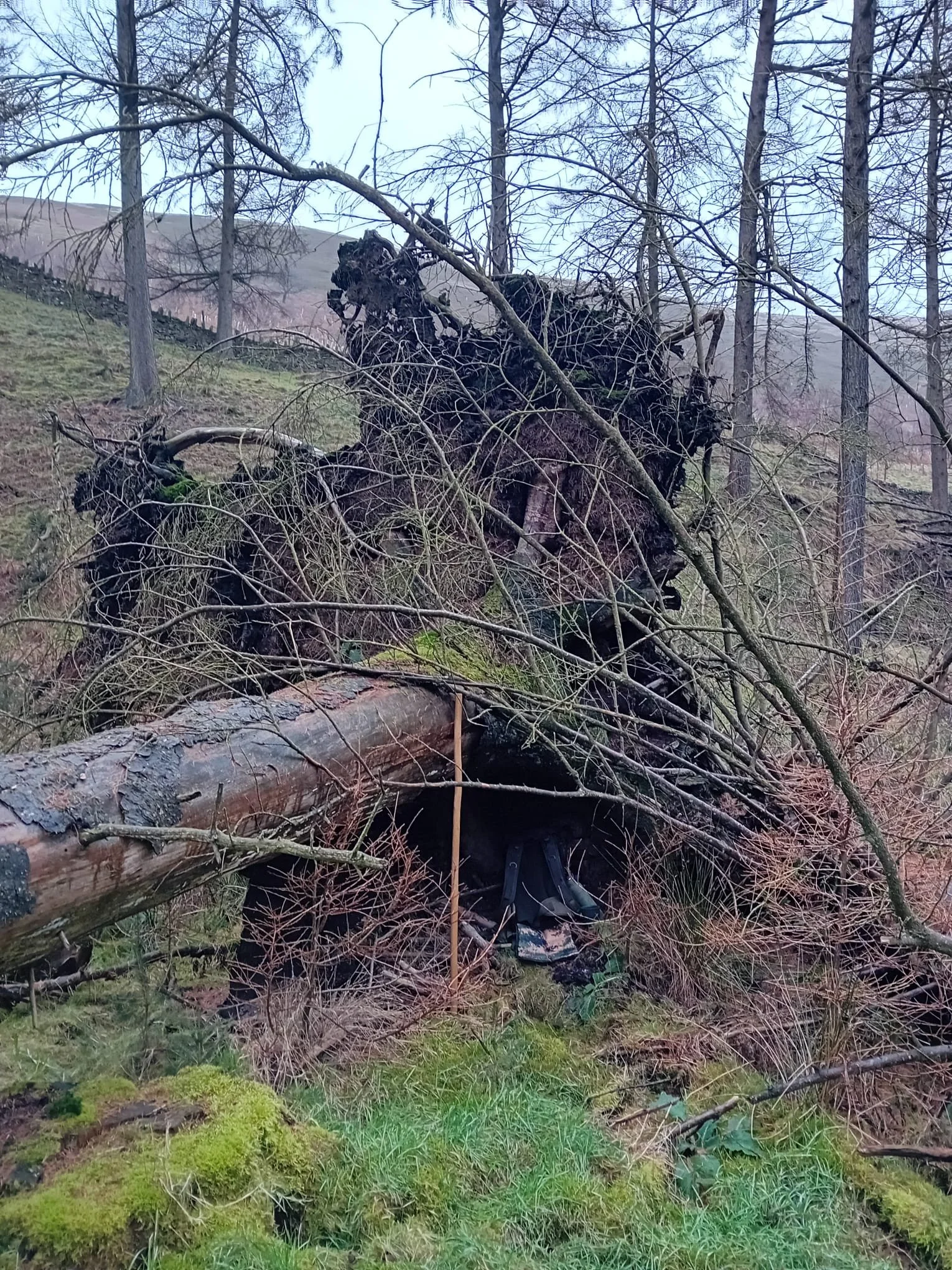
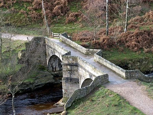
Approaching the top end of the reservoir, I sheltered for lunch under a fallen tree, then arrived at the old packhorse bridge, which was relocated from the village up to Slippery Stones.
The deep valley in which the village sat, with its high rainfall, made it a good site to settle, well provided with water for agriculture and to power the mill. It was also these very characteristics that made it so suitable to become a reservoir.
Heading down the western side of the reservoir, on a footpath that was once a railway track, I reached the site of what was once Birchinlee, also known as Tin Town. This was a temporary village built by the Derwent Valley Water Board to house the workers brought in to build the Derwent dam between 1902 and 1916. The village included a post office, hospital, school, railway station and canteen which also served as the pub, shops, a recreation hall, police station and even a bath house, with the population reaching nine-hundred.
The dams built by the residents of Tin Town were Howden and then Derwent, not the one which would flood the nearby village. Yet it must have been a strange contrast for the residents of the small, quiet village of Derwent to have this settlement, housing more than eight-times the number of people, appear in the valley that was their home, the land above them gradually flooded. Derwent dam in particular is an imposing structure, over a hundred feet high and more than a thousand feet wide. Sited about a thousand yards from Derwent village, this would have dominated what was once open countryside, looming over the residents, holding back over nine-million tonnes of water.
As the residents of Birchinlee finished their work, Tin Town was dismantled, parts of the settlement being commandeered by the War Office and used in prisoner of war camps. Now, there is little left to show that it was ever here.
The church of St John and St James in Derwent held its final service on 17 March 1943, the residents moved out, the buildings were demolished and the waters steadily moved in.
This map shows the area of the village of Derwent which now lies underwater, bounded by the modern-day shore of Ladybower reservoir. Researched from national archives and geospatially correlated to the reservoir, this map prides an insight into this now lost village in the heart of the Peak District.
The area around these reservoirs is amongst my favourite stomping-grounds, and whilst walking I often wondered about the old village beneath the waters. It was a real pleasure, and fascinating, reading into the history of the area and poring over the old maps to build a picture of what lies beneath.
All of the cartography is my own and no AI us used in my work.
Print Options; archival (A3)
Unframed £48
Framed £68
free world-wide shipping
Notes: Each piece is individually printed, and subtle variations in tone and finish may occur, reflecting the nature of fine art production.
This map shows the area of the village of Derwent which now lies underwater, bounded by the modern-day shore of Ladybower reservoir. Researched from national archives and geospatially correlated to the reservoir, this map prides an insight into this now lost village in the heart of the Peak District.
Print Options; memento (a5)
Notes: Each piece is individually printed, and subtle variations in tone and finish may occur, reflecting the nature of fine art production.
